Brief.

In summary, we will be creating an interactable prototype of a weather app as the outcome for the project. To achieve this, we need to proceed PACT analysis, make multiple personas, sketch out wireframes and prototype them.
Part one.
PACT & Research.
According to the brief, we will be choosing one user group from school children, skiers & mountain sports enthusiasts or cyclists & motorbike riders. For the purpose of proceeding research as well as to complete the project, I will be choosing mountain sports enthusiasts as my user group.
I will be first doing research on each topic of PACT (People, Activities, Contexts and Technologies), and then dive into the actual analyzation.
People & Context.
To understand who mountain enthusiasts are, I did the following research & reflections:
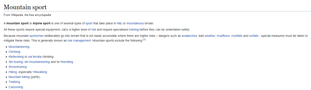
This is a screenshot I took from Wikipedia, usually refer to so-called ‘unprofessional’ website. It gives a list of mountain sports where I can reduce the scope and receive preciser data. In this project, I will be focusing on Hiking, Climbing and Mountain biking, because I have experienced them one or two times previously.
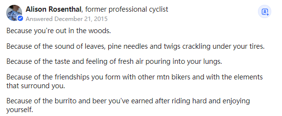
1. Hiking.
According to Pack Your Tent,
Hiking is the activity to describe walking in natural environments, usually done for pleasure. It usually takes place in the countryside, woods, our mountains on trails and footpaths. Hiking is a “catch-all” term to describe many outdoor walking activities including nature walks, trekking, and backpacking.
As the hiking is just walking quote goes, “if you can walk, you can hike”.
In conclusion, hiking takes place in natural environments instead of civilised areas, it helps people to relax and feel positive. Furthermore, hiking requires planning due to the fact that it is easy to get lost in the woods or the mountains, therefore a well planned trip will be extremely helpful. Notice that Trekking also shares the similar feature as hiking, therefore it is also included in hiking. I found some answers to the question ‘Why did you start hiking?’ on Quora:
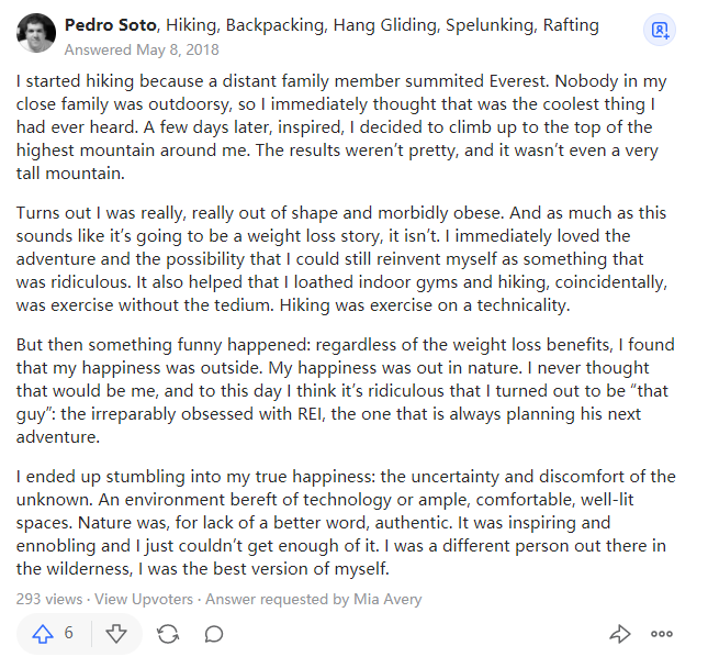


I found these answers intriguing, because some people view hiking as a method to escape from the reality; Some people take it as a life achievement to approach and accomplish. Most of the people were brought into this field by their parents. One of them learnt how to survive in the woods, and some of them just enjoy the feeling of being a part of the natural environment. One common I found from these people is that they are all enjoying hiking, they are not taking it as a job but instead it is a way to relieve the burden on their shoulder in reality, and throughout them away in the wild. When I am designing the weather app, I will be considering this feature because it should be emitting the positive energy instead of being boring and negative.
Key word: Interesting, pleasure.
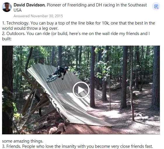
2. Climbing & Mountaineering.
According to Britannica,
Mountaineering, also called mountain climbing, the sport of attaining, or attempting to attain, high points in mountainous regions, mainly for the pleasure of the climb. Although the term is often loosely applied to walking up low mountains that offer only moderate difficulties, it is more properly restricted to climbing in localities where the terrain and weather conditions present such hazards that, for safety, a certain amount of previous experience will be found necessary. For the untrained, mountaineering is a dangerous pastime.
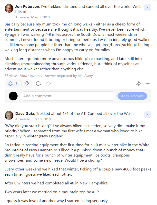
In general, mountaineering is a relatively dangerous sport to do, which requires professional equipments as well as training before attending. Here are some Q & A of how people have gotten into this activity:


I found these answers interesting because they are similar to the hiking ones. Most of the people have gotten into this activity through casual events, and suddenly realize that they are enjoying what they were doing. Some people enjoy the moment when they climbed up to the peak and see the gorgeous view, and some of them love the process of sweating as well as the experience of taking on an adventure.
Key words: Adventure, accomplishment.
3. Mountain biking.
According to Marina Parra,
Mountain biking is the activity of riding a bicycle on different kinds of off-road trails. It requires endurance, speed, balance and technical skills to navigate through rough terrains. Unlike road bikers, mountain bikers pursue obstacles and see the world as a natural and challenging playground full of winding trails. Vertical downhill sections, steep ascents, loose rocks, water crossings, tree roots: everything is an opportunity to put their abilities to the test!
In conclusion, Mountain biking is different from both hiking and mountaineering, because it requires more focuses on the speed, techniques and the surroundings. During this activity, route planning is extremely important because there might be risks to cycle in an unexplored area, which could lead up to get lost in the mountain, or even worst to encounter life threatened dangers. Here are some Q & A on ‘Why is mountain biking is so awsome’:


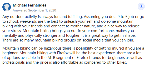

Most of the answers are similar to hiking and mountaineering, but there are one or two people have shared some interesting views: Mountain biking provides freedom thus the cyclists don’t need to follow a specific route, they can customize it and make this sport explorable. To an extend, cyclists can build their own platform to cycle, which is a cool feature that both hiking and mountaineering don’t have. Furthermore, it is the same as the hiking and climbing, mountain biking is suitable for group activities, therefore people can build their friendships very quickly.
Key word: Community, freedom.
Here are some useful charts that present useful data about hiking below:
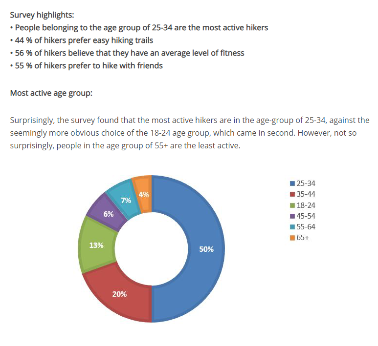
According to the data shown above, the most active age group for hiking is 25-34.
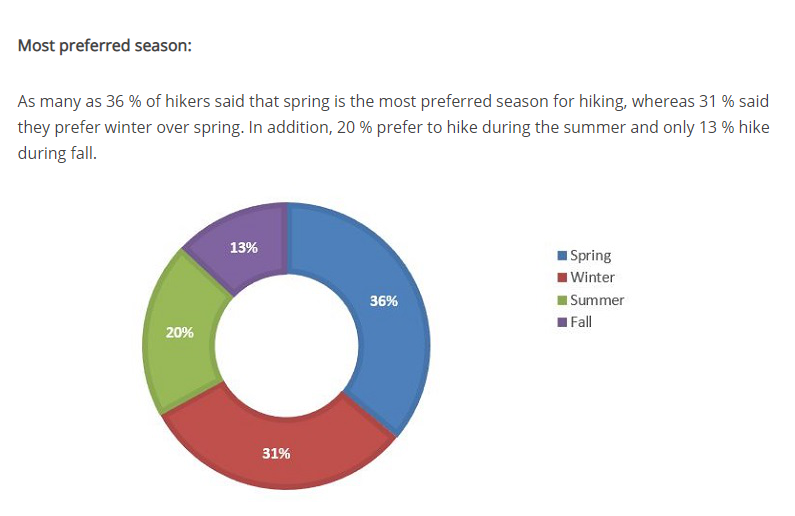
According to the chart above, the most prefer season for hiking is spring.
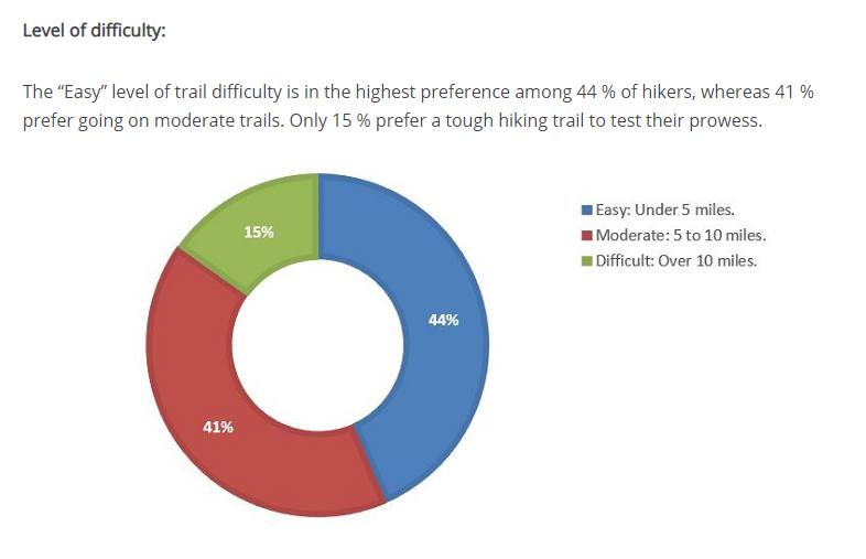
According to the chart above, most people hike for under 5 miles.
In conclusion, people who do mountain sports are doing them for fun and relief of the burden. They enjoy being a part of the natural environment, building friendships and keep fit. Although I am building a weather App, one thing I need to consider is that these people want to spend most of the time in the activities instead of the App, therefore the App shouldn’t have any redundant function.
Activities & Technologies.
After figuring out who and why do they do these activities, I then moved onto what do they do in these activities, in order to figure out where I can fit my weather app into:
1. Hiking.
Here is a video presents 10 essentials of hiking, they are:
1. A map of the area
2. A compass
3. A flashlight with extra batteries and bulb
4. Extra Food
5. Extra clothing, including rain gear
6. Sunglasses and sunscreen
7. A pocket knife 8. Matches in a waterproof container
9. A candle or other fire starter
10. A first aid kit.
In this video, we can see the essential equipments are always using for life saving, which is a considerable feature in my app. This makes me think of compiling some of these features into the app, which will certainly save a lot of storage and mobility during the hike.
2. Mountaineering.
Here is a video shows some tips and suggested equipments for mountaineering.
As what’s shown in the video, mountaineering requires more professional gears, and the gears are only usable when they are needed, in other times people are just walking and paying attention to the surroundings. In terms of creating a weather App, I need to consider what are the moments they are going to take out the phone and use it, and is it dangerous to make them use the app whilst they are climbing?
3.Mountain biking.
Here are some tips for mountain biking beginner:
Mountain biking is quite different to the mountaineering or hiking. Instead moving step by step, mountain biking always move in a faster speed, therefore paying attention to the surroundings whilst cycling is already hard to do. Therefore, the weather App should be functioning without disturbing the cyclists and put them in danger. Furthermore, cyclists are always moving on the bike, therefore the level accessibility is also considerable for the App.
Weather system & app in games.
It might be difficult to go out and experience these activities due to various of reasons, but video game as a new type of interactive media allows people to experience certain things without going outside. Furthermore, game designers are actually people who solve problems, therefore I can use video games as great research sources in this project, since weather mechanics and systems have been well developed in many games to use as simulators.
1. Death Stranding.
Death Stranding is a game which highly involves with hiking, climbing and mountain biking mechanics. The essential experience of the game is to have the feeling of loneliness and accomplishment during or after delivering the packages in after a devastated world. Here is a footage of what death stranding looks like:
The game simulates walking, running and other actions extremely well. When the player carries too many packages and tools, they will slow down and reduce more stamina, and the worst case is to lose balance and fall into the ground. The game is taking place in the devastated world, therefore the players are mostly dealing with the environment such as rains, storms, river, mountain and other sophisticated situations. There are couple of interesting weather systems in the game that are really inspiring:
Weather App in Death Stranding, video recorded by GameSpot:
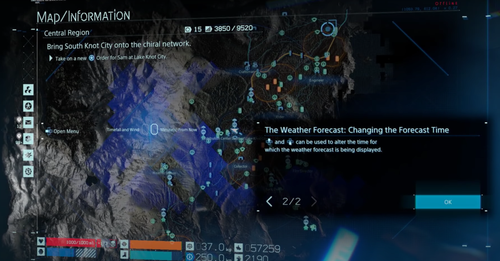
The image above is a screen shot of the weather app in Death Stranding. As we can see, there is a map in the App, and some of them are covered by a thin layer of blue. The covered bits are the areas that are currently raining. During the gameplay, players will be able to adjust the time to foreseen the weather in the upcoming 30 minutes.
This is a very interesting design, because instead of telling you the weather in your region, it actually makes it preciser and adjustable by the users for different needs.
Another interesting feature in Death Stranding is that the rain actually devastate things throughout the time, therefore having a shelter is a good way to stay safe:
The game mechanic of building a shelter by one player but can be used for other players also inspires me. Maybe in the weather app, a function of spotting shelter would be useful. In that case, the weather app is not only just an app, but also a communication tool which brings people together, or even saving lifes.
2. The Legend of Zelda: Breath of the Wild
The legend of Zelda: Breath of the Wild is an amazing game that has great physics system, and one of them is getting electronic shock when carrying metal weapons/armour in the storm, and here is the video showing the tips of how to avoid it:
In addition to the weather mechanic in the game, this tutorial inspires me to have an idea of providing informations or guidances to deal with the particular weather when it is about to happen. As we know, the weather app is designed for people who are most likely in the natural environment, therefore some tips of dealing the up coming situations might be useful or even life saving.
3.Assassin’s Creed: Black Flag.
Assassin’s Creed: Black Flag is the 4th game in the series, the setting has moved from the 18th century America to Carribean. This means that the gameplay mechanic will be mostly focusing on pirate ship manipulations. Here is a weather system showcase in the image below:
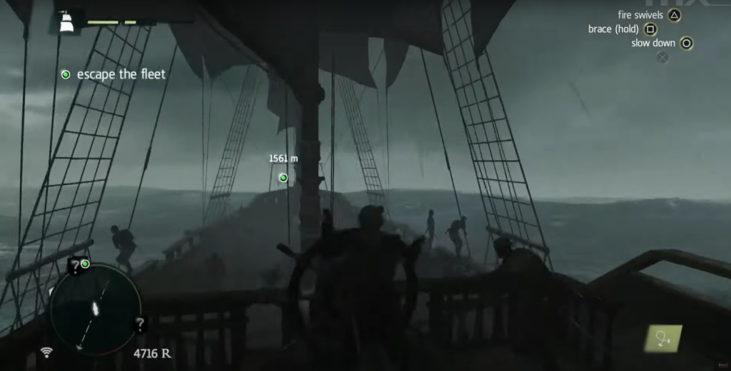
Apparently the player is encountering a horrible storm in the game, but it is noticeable that the mini map in the left hand corner has an arrow appeared in the center. This arrow is the the wind indicator, which is extremely helpful when manipulating the ship. In my opinion, this is a great feature to implement into the weather app. In addition to the wind, there could be more ‘indicators’ in the app, in order to assist users in various of situations.
Weather apps.
Here are some researches I have done to view the popular weather apps present:
The video has made clear reviews on Today weather, Yahoo weather, 1 weather, Clean weather, Weather, Foreca weather, Overdrop and Eye in sky. According to Lotoftech’s review, I think most of these apps are designed for more professional purposes and also contain more texts rather than visualizations. For instance, here is the weather app on IOS system:
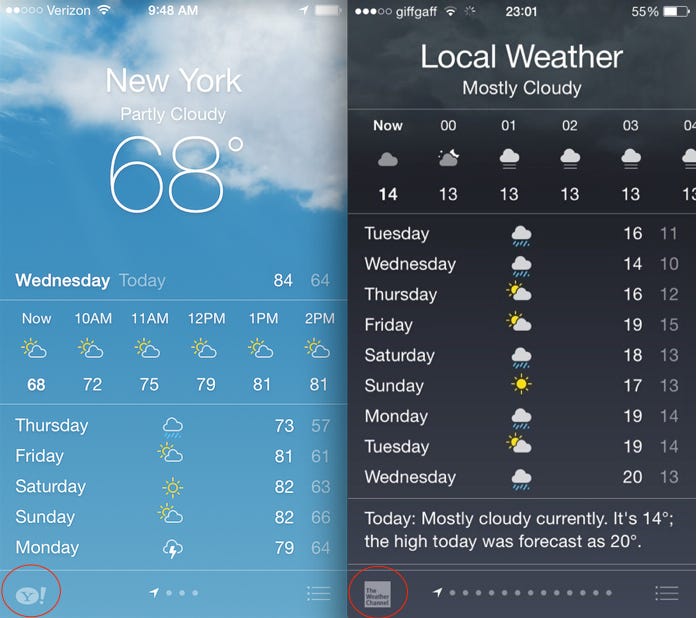
According to the image above, all I see is text with minimal visualizations. It gives me redundant informations that I don’t really need right now(as a mountain sporter), except the current and the upcoming weather.
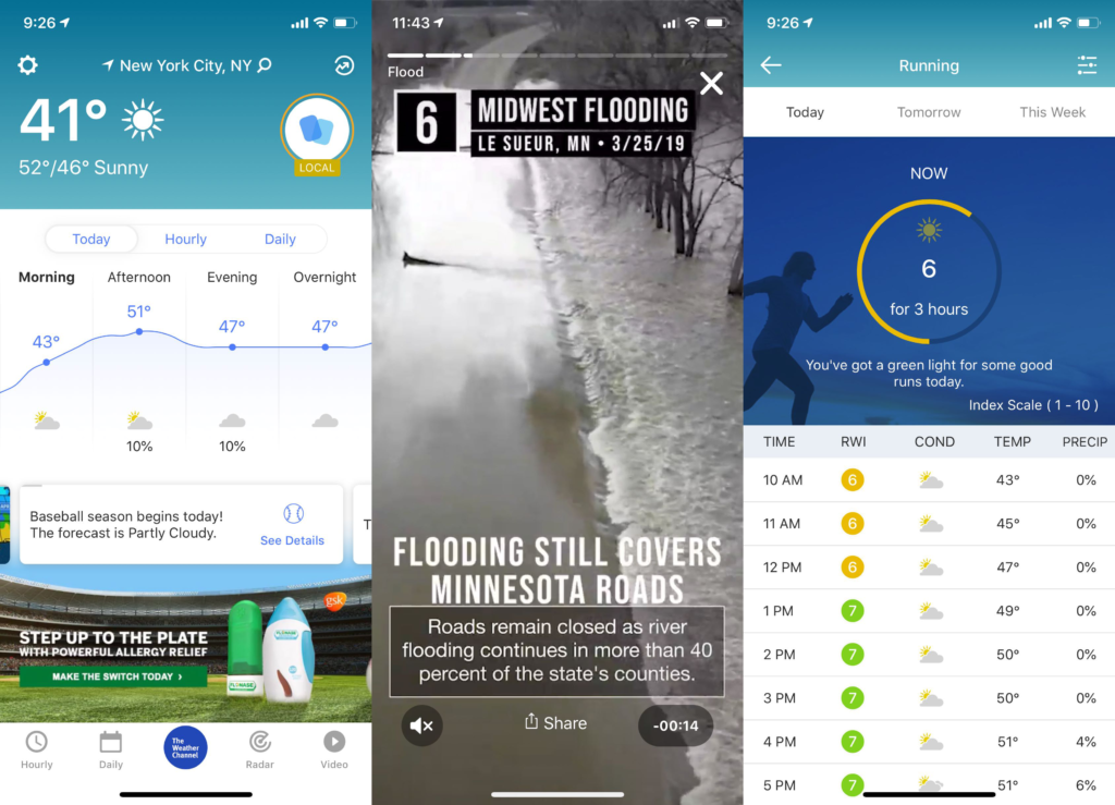
Here are more examples of the weather app. The common issue of them is that they through too many information into one interface, and disturb users to find what they actually need. For instance, if a mountain climber wants to know if it is going to rain in the next 10 minutes, a minimal interface will be helpful, especially when the climber is half way climbing a mountain.
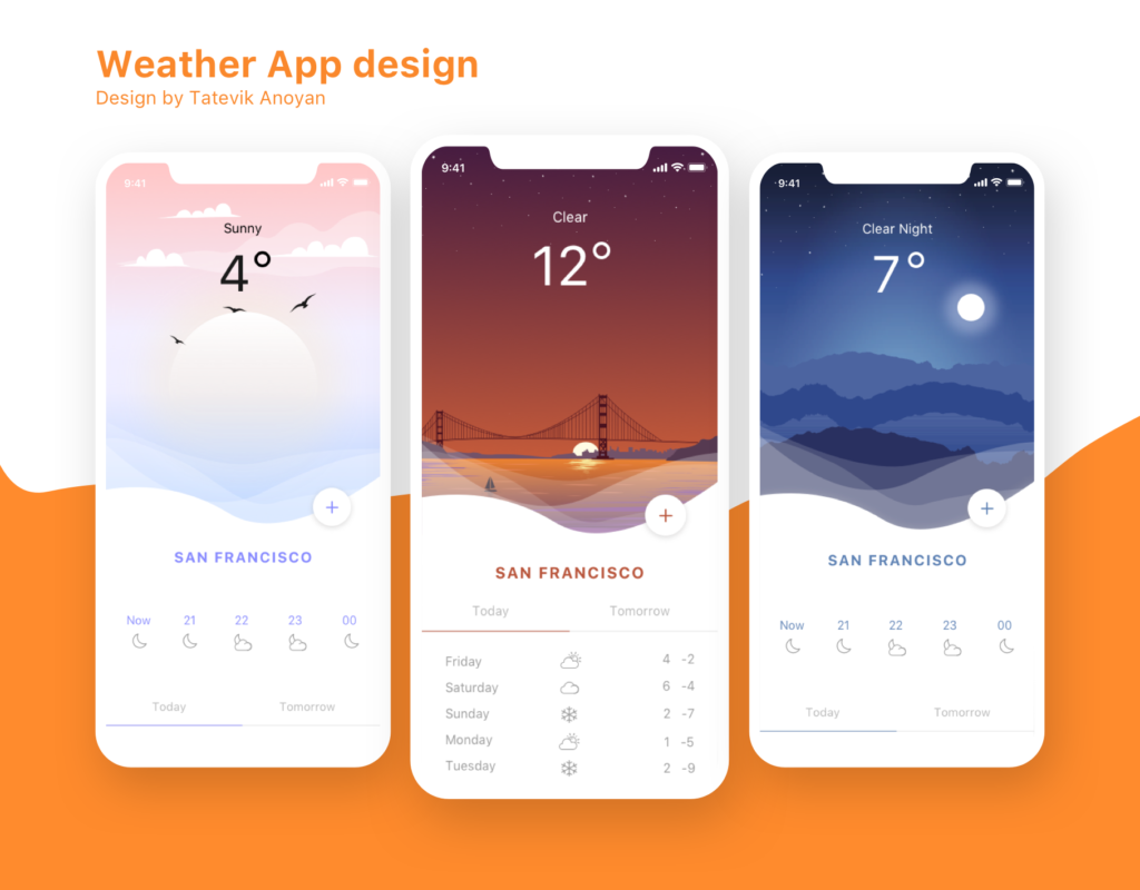
This is a good example. It has simple interface with great affordances. The colours show the current weather, and semiotic features are underneath with simple texts to indicate the upcoming weather.
Here are some apps for mountain sports enthusiasts:
Here are couple of apps that I think is useful to do research on:
1. AllTrails
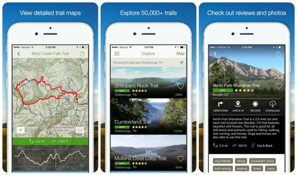
Alltrails provide users abilities to plan their trails, upload the trails and view other people’s trail. It has risk analysis as well as the weather system to inform users about the weather, UV light as well as the daylight. I really like the idea of combining trails with the weather system because the users don’t have to open up two apps to figure out the weather and the trail, by compiling both it saves a lot of time and effort.
2. Geocaching.
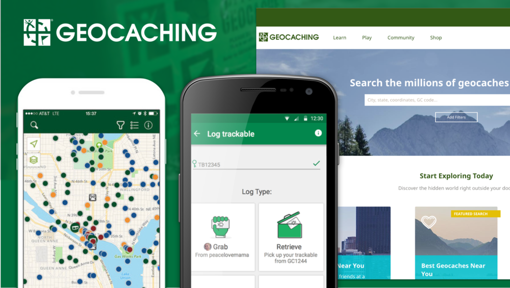
Geocaching is an app which allows people to go outside and find interesting objects that are hidden by other people. I like the idea of ‘leaving’ and ‘receiving’, and I think this could be a cool feature in the weather app. It would be useful to leave useful supplies in the mountain, as well as the useful information that every can see on the app.
3.Opensummit.
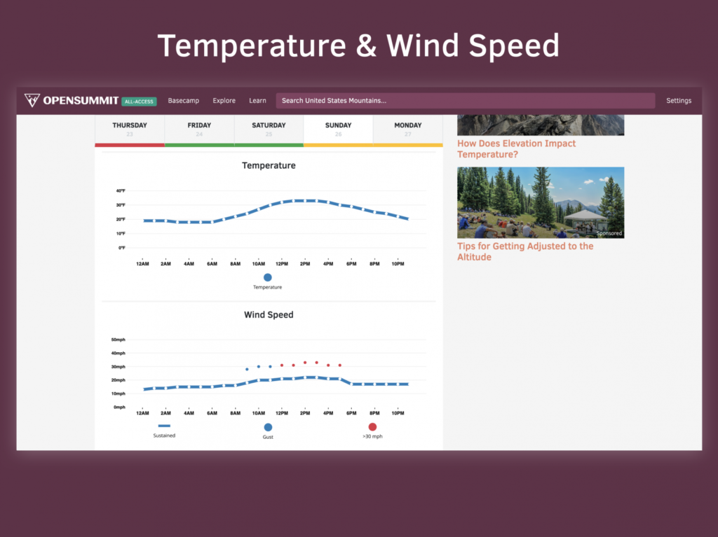
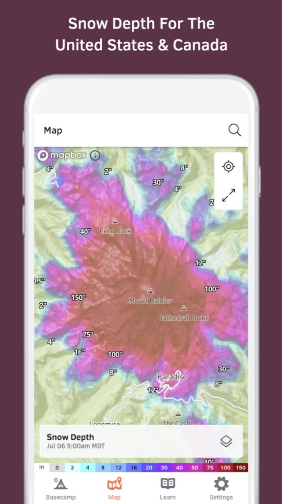
Finally, this weather app is useful for mountain sports because it gives clear information of the weather changes in a specific area. Furthermore, it has risk assessment of the upcoming weather, such as storm and snow. I think this could be developed further in my weather app.
PACT Analysis.
Here is a rough analysis of PACT:

PEOPLE.
The target users for this app is the mountain sports enthusiasts, including Hiking, Mountaineering, Mountain biking etc.. Although the app is mainly focusing on the outsiders, it is still suitable for daily usage, such as planning route for going to work, or explore new areas and leave captions there, or just for checking weathers. The app should be easy to use because it is mainly for people doing the dangerous activities such as mountaineering, canyoning or even mountain biking.
ACTIVITIES.
The app is mainly used for checking weather when people are before or in the middle of mountain activities. It detects the upcoming weather from 10 minutes to the next day, or next week. The app will have minimal interface and only require simple interaction to access different functions. Notice that people might be using it whilst they are mountain biking, therefore a quick interaction or even sound control will be able to activate the functions.
The app can not only indicate the weathers, but also helping people to plan their trails and used as a GPS. The reason for implementing this function into the app is because it takes a lot of time and effort to have multiple apps on, and switch between them to get different informations.
Furthermore, tips will be an unique feature in the app, it suggests what to do if there is an extreme situation happens, for instance, a storm. This function could save people’s life.
At last, leaving and receiving messages is also a function in the app. Users can indicate what places are dangerous or beautiful, and share their thoughts on the app. The reason for doing this is because it brings the users together and create a community which allow them to help each other, spotting interesting places, avoiding dangerous routes or even making friends.
CONTEXT.
More and more people are going outdoors to explore and enjoy the natural environment, to relief from the reality. Mountains, fields and cliffs are getting more popular nowadays. It does take a lot of effort to plan, purchase or even participate the activities, however, lots of people enjoy doing these things. Tons of Apps in the store, from trail planning to weather indicator, and there are indeed useful apps. However, it takes effort and time to open up multiple apps and switch between them, especially when the users are in the middle of climbing or mountain biking. Furthermore, most of the apps are full of redundant informations as well as the sophisticated UI, to make the worst UX. This weather app is aimed to ease the complicated usage from the existing apps, and focus on the activities they are doing whilst receiving the precise information they need.
TECHNOLOGIES.
The users can easily access the app by interacting with the logos and buttons on the interfaces, and each one of them will be having high level of affordances to make users easy to understand and use. Furthermore, voice control as well as the voice indicator will be available in the app, this is designed for those who don’t have the abilities to access with hands. Offline mode will be available, however, the functions will be limited due to the fact that weather indicator requires internet. Nevertheless, users will be able to download the weather data for the next couple of days, therefore they can still use it offline, just not as precise as when the internet is available. GPS will be activated all the time, and the planned route can be downloaded for offline usage. At last, users can download all the informations that other users have left when the internet is on, so that they can view it in the offline mode, and share their own thoughts when there the internet is available. Therefore, the users can pretty much use the most of the functions offline.
PERSONA.

In David’s Persona, he mentioned that the apps nowadays always provide redundant information and sophisticated interfaces, that make them hard to use as well as receiving useless information. Therefore I will make the aesthetic with as minimal features as possible, because it is focusing on the usability instead of the aesthetic. Furthermore, David does not like learning and handling too many apps at once, therefore adding a trail planning function would be good.

John is an introvert person, who spends most of his research online instead of receiving suggestions from friends. Therefore it is important to give him the correct information instead of false information. Furthermore, customization is also a good idea to implement into the app, because different users have different needs, so that they can adjust the amount of information they would like to recieve.

Jane is an extrovert, who also enjoys irritative sports such as rock climbing and cliff canyoning. These activities make her difficult to receive precise information when needed, for example, she is half way climbing the mountain, and it seems like it is going to rain. In this case, she needs to decide whether to find a shelter or keep ascending, depends on when and how long it is going to rain. There are two issues over here: Firstly, she might not be able to take out her smartphone and open up the app to get the information; Secondly, she needs percises information of when it is going to rain, and for how long. Therefore, the solutions for these issues could be designed into the app in order to help people like Jane.
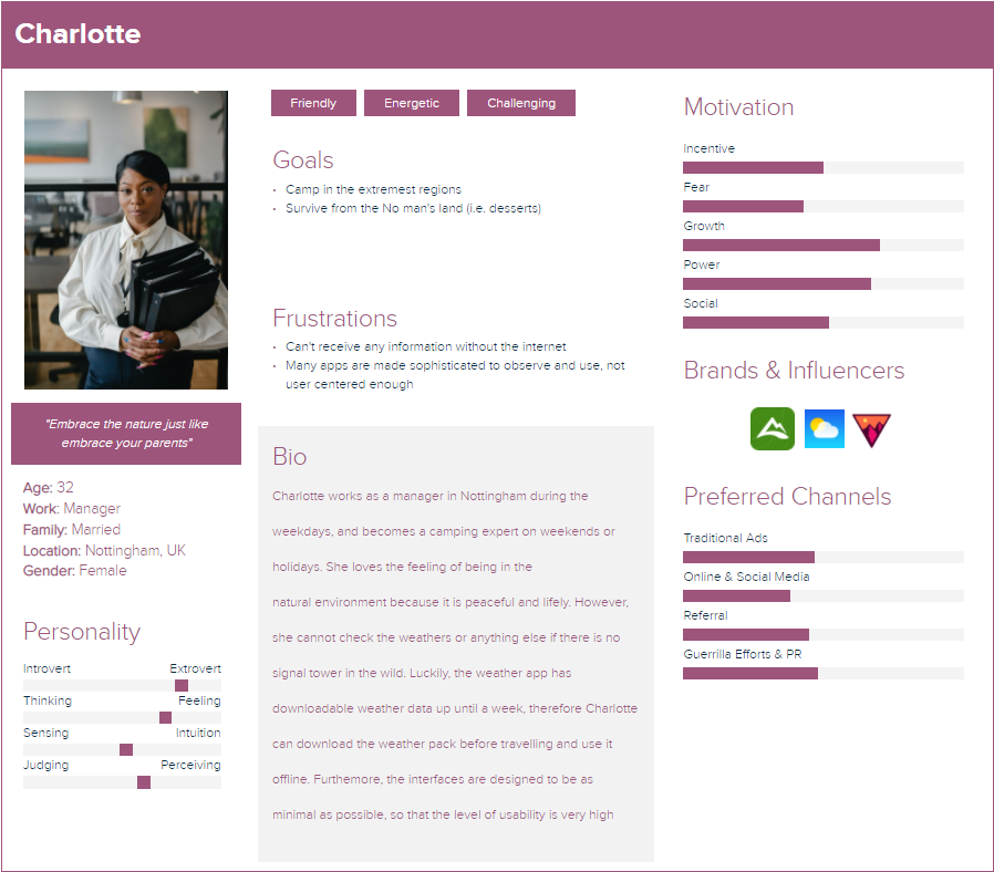
Charlotte has stated a good point in this persona, which most of the apps require internet to function. Therefore adding an offline mode would be beneficial. Furthermore, she loves camping, which can be considered as a group activity, therefore, she can make friends through the community function in the app, and maybe receive some useful tips from other people in the specific area.
Initial Ideas
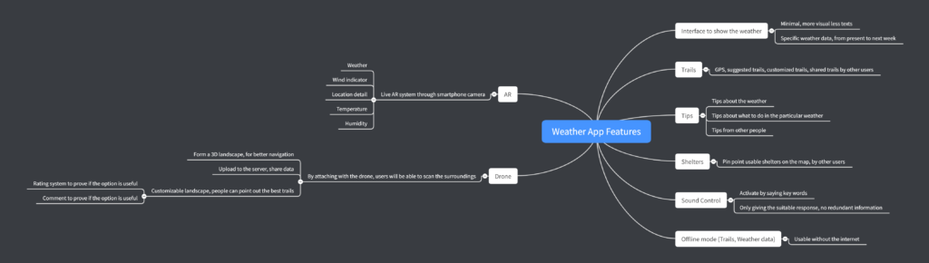
Here are some thoughts for my weather app:
Firstly, the interface needs to be easy understandable with advance affordances. This is a weather app, which means that the design is mainly focusing on the weather instead of other functions. For the sake of user’s safety, there will be tips about how to survive as well as the possible hurdles users are likely encounter in the particular weather, for instance, a storm. Furthermore, this app has GPS, which allows the users to plan and see their current locations. The community of the app is also helpful in terms of spotting shelters and userful locations. For example, a user is encountering an extreme storm, and she opens up the weather app, find the ‘shelter’ option. In this option, there are locations where the other users have spotted and pinpointed in case someone has caught in a storm or in any other situations. In addition, Augmented Reality option is available in the weather app. It requires live camera and can be used to detect the current temperature, sea-level, locations as well as the weather in the located area. At last, offline mode is available for the app. Users are able to download all data (including trails and weather) when the internet is on.
In order to visualize my initial idea, I made a simple interaction map. There are three interfaces in the map: Major interface, Minor interface 1 and Minor interface 2. Major interface appears when users first enter the app, it shows the major functions or paths to the rest of the options, they are: Weather UI, Tips, Trails, AR and settings. The minor interfaces are the suboptions in the app, which also have important functions but more selective.

Roughly-Rough Ideas
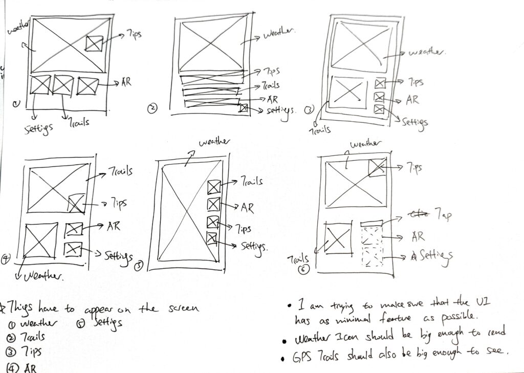
For the first set of roughly-rough ideas, I listed 5 key elements on the page: Weather, Trails, Tips and settings. Theses are the fundamental interfaces for my weather app. As we can see, the weather UI usually takes the largest space, because afterall it is still a weather app. In comparrison, the rest of the options are less important, because they are only functioning as a portal to the rest of the functions. Howeverm, in sketch 4, trails take up the most of the spaces, because I wanted to see what it looks like, if the app works like a GPS instead of the weather app.
The second set of design is simliar to the first one, I was just testing out the basic composition between each UI.

Whislt I kept stretching the weather UI, I realized that it would be cool if I can layer both weather UI and GPS UI on top of each other. The purpose of designing it like this is because if a user is cycling on a mountain, they don’t have to stop and switch between the interface anymore, they can just quickly scan the screen and receive the data they need. This design does not only save a lot of time, but also a life saving function.
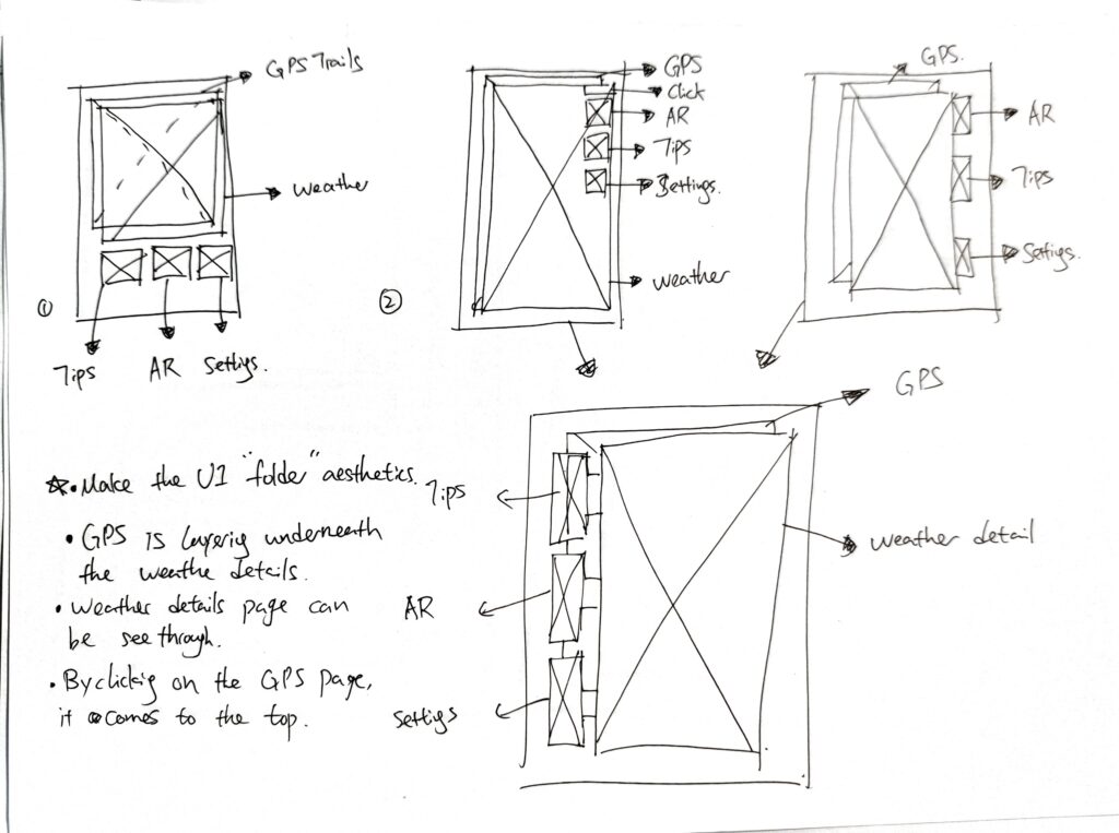
The idea of layering interfaces on each other inspired me to create a folder-like design. Instead of click and open, the options will be showing on the side of each page. This will be denmonstrated in detail later.

According to the above image, I used a seethrough paper to experiment with the layering interface. In my opinion it looks pretty cool, but there are still some adjustments can be made to improve it. For instancec the interface should be cleaner, so that the users can immedietly pick up the information they need.
Furthermore, the layering design is shown in the image above. GPS page is underneath the weather page, and there are tags stood out on the right hand side of the pages, and users can simply tap on them to activate them.
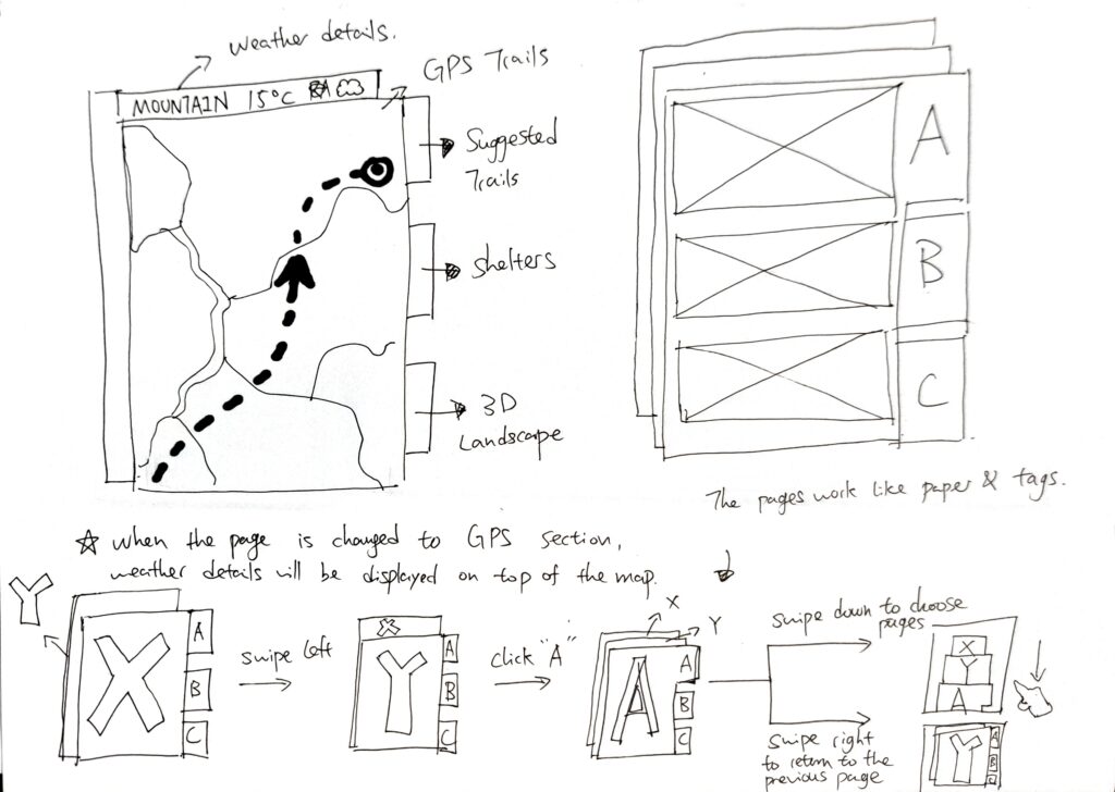
Image above is a clear demonstration of how this could work, roughly.
Precisely-rough Ideas
Once the roughly-rough ideas were sketched out, here comes to the precisely-rough sketches:

This sketch shows how the interfaces change from the major interface to the minor ones.
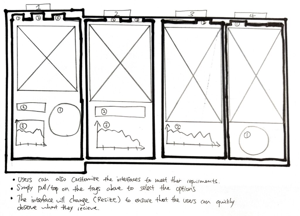
One thing it mentioned in David’s persona, is that there too many redundant information in the apps nowadays, therefore it is sometimes better to reduce instead of increase. There will be tags on top of the page, which indicate a feature on the screen. By simply pulling or tapping, the features will either disappear or appear, depends on the user needs.
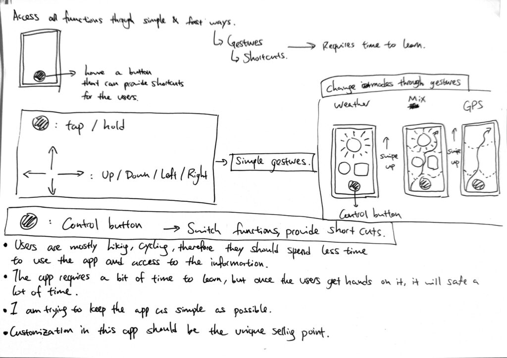
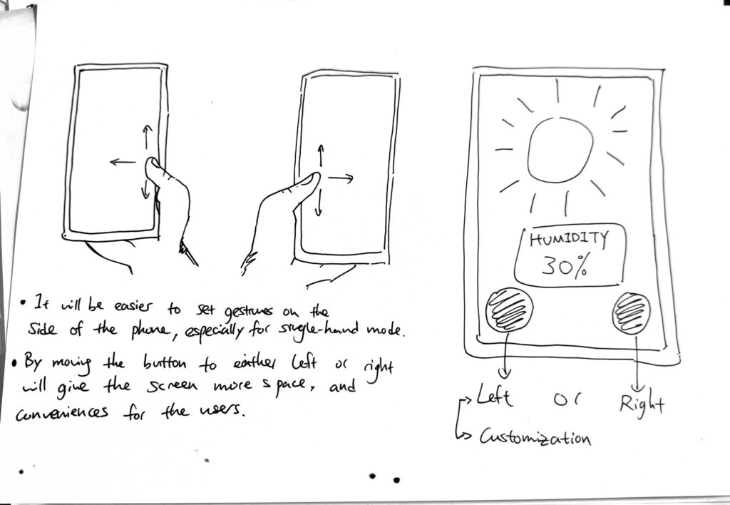
In the crit on Tuesday, one of my classmate has mentioned that it will be difficult to tap the upper part of the phone since the area might be covered by camera, therefore I need to come out with something new in order to make the customization happen.


High resolution image please see here.
User test session.
We had a user test session on Tuesday, the aim for this session is to figure out what could be the improvements for the initial prototype.
My classmate Yang mentioned two very good points in the test session, she said that the red button is minimal but has a lot of functions that might confuse the users, a tutorial might be a good idea. She also mentioned that the topographic map is important for hikers because they need to know about the heights and the shapes of the environment when planning the routes.
Based on her suggestions, I decided to move further and start developing my idea to its final edition.
Improvement.


Final prototype.
High resolution image please see here.